Quarry Volumetric Reporting
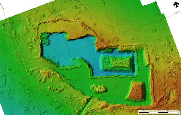
Digital elevation model animation
Volumetric reporting is the process of calculating the differences between ground surfaces at different points in time, either due to filling (increases in surface level) or cut (decrease in surface level) or a combination of the two. By comparing the two measured surfaces, we can determine the change in volume during the time period. This process is fundamental to compliance requirements put on operators of landfills and quarries for example.
In the case of quarries, the amount of material extracted can be subject to royalty payments or linked to a quarry license where the annual extracted amount is required to be reported each year. From an operational perspective, often the amount of material extracted needs to be valued as an asset, and this is where accurate measurements are extremely helpful.
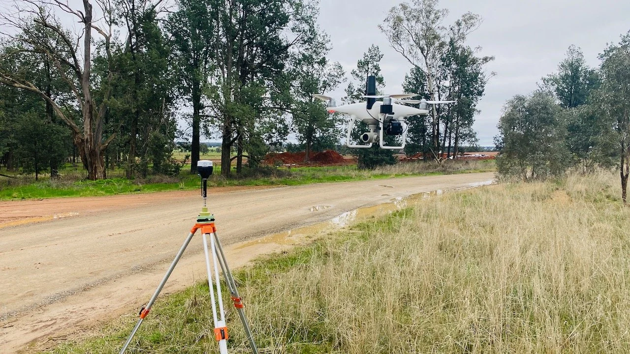
12P Consulting has been helping Federation Council report on their two main quarries at Daveys Hill and Balldale since 2020. The work has involved the capture of a site digital elevation model at the start and end of each financial year so that comparisons can be made to the surface elevation and hence volumetric changes can be calculated.