Our services
-

Digital Site Capture
FEATURE AND LEVEL SURVEYS | DILAPIDATION SURVEYS | 3D CONCEPT PLANNING
12P Consulting is equipped with Remotely Piloted Aircraft and survey-grade GNSS receivers that enable highly accurate (<2cm) feature survey models to be generated in a fraction of the time required for fully land-based surveys. We use high-end photogrammetry and LiDAR software to provide a range of 2D and 3D spatial products to suit your requirements. These include georeferenced orthophotos, digital elevation models and highly detailed terrain models ready for civil design. We can tailor a product to meet the requirements of your project.
-

Aerial Laser Scanning (LiDAR)
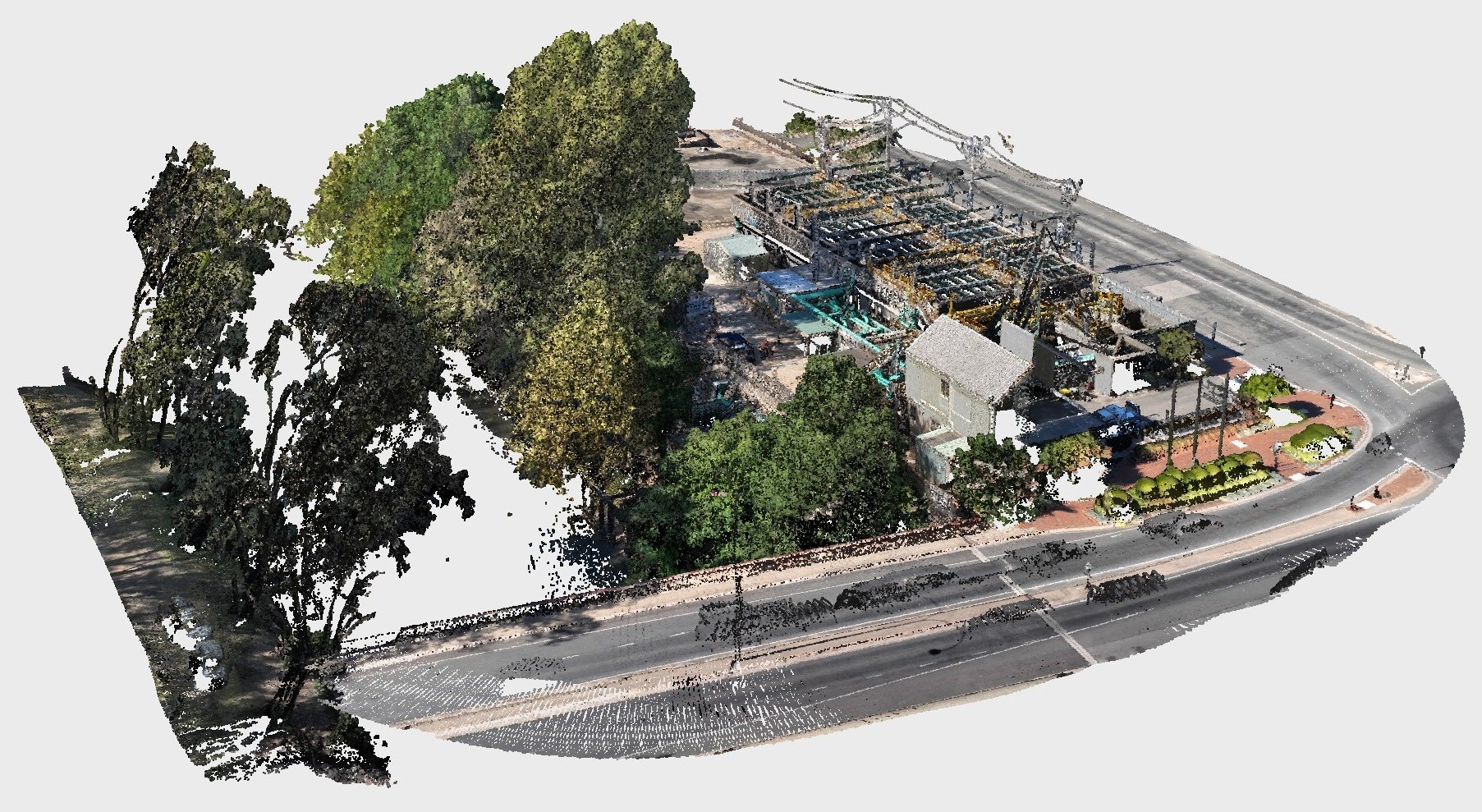
Our aerial laser scanning (LiDAR) services utilise UAV technology to capture detailed data of civil infrastructure assets. Our UAVs provide can generate dense point clouds essential for infrastructure planning, monitoring, and maintenance. We ensure precise data collection, even in hard-to-reach areas, delivering comprehensive insights for bridges, roads, railways, and other utilities. This Information supports informed decision-making and proactive asset management. Enhance your infrastructure projects with our cutting-edge aerial LiDAR technology.
-

Site Monitoring
AERIAL 360 PANORAMA | VIDEO | IMAGERY | TIMELAPSE
Site monitoring provides project managers with essential insights into how their project is progressing and provides early intelligence of deviations to construction plans.
Automated flights that yield precise 2D orthophoto and photo locations can be replicated over time, allowing projects to be accurately tracked for quality and scheduling purposes.
-

Bathymetry
BATHYMETRY | RESERVOIR VOLUMETRIC ANALYSIS | UNDERWATER MAPPING
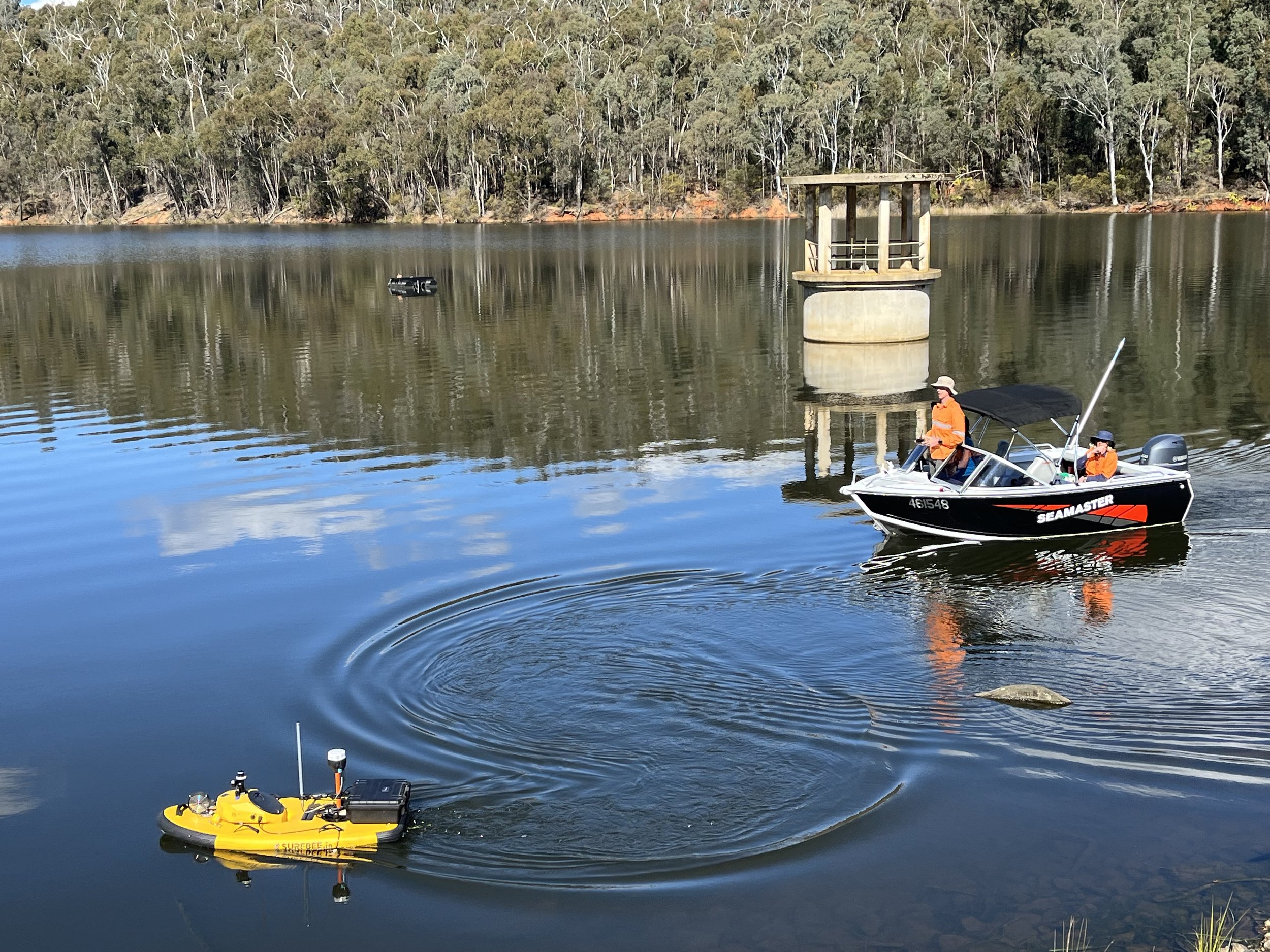
We have the tools, resources and knowledge to undertake bathymetric work on reservoirs, treatment lagoons, rivers and other water bodies using remotely piloted boats and aircraft.
Our unique approach delivers efficient and detailed information to help in the management of water industry assets.
-

Custom Mapping
We offer a custom mapping service perfect for large properties, farms or commerical premises to allow owners and managers to plan future works or simply understand the landscape better.
This service provides high quality georeferenced imagery with property boundary linework, 0.5m contours, above-ground services, vegetation and other visible features drawn on an easy to use plan.
Outputs can be shared in 2D and 3D PDF format as well as AutoCAD format, 3D point cloud and many others depending on the project requirement.
Contact us today for a quote.
-

Project Management
CIVIL | TECHNICAL
With over 25 years in the civil construction and building industries, we draw on a very broad range of experience to ensure the success of your project.
Our project management experience, technical skills and capabilities come together to effectively plan, measure, control and deliver multiple projects simultaneously.
We have experience in municipal projects, including sports grounds, roads, bridges, cycle paths and drainage, as well as water industry projects, recreational trail management and remote project sites.
-

Volumetric Surveys
LANDFILL | QUARRY | BULK MATERIALS
Volumetric reporting forms an integral part of a number of essential services industries across Australia. These include extractive industries such as sand and hard rock quarries, precious mineral extraction and landfill sites.
State governments typically require regular reporting on the volumes of material extracted from a quarry, or the volume of waste material taken to landfill. In addition, the day to day management of such sites can benefit greatly from regular surface modelling and analysis.
12P Consulting provides a regular field survey and detailed reporting service for extractive industries and landfill operators across the North East of Victoria and Southern NSW. We also have the ability to undertake density testing to convert volumes to material mass.
-
Asset Inspections
BRIDGE INSPECTIONS | CRITICAL INFRASTRUCTURE | NATURAL ASSETS
Using UAV it is possible to safely inspect otherwise remote or inaccessible infrastructure and natural assets.
Our fleet of UAVs provide a range of sensors to gather critical insights for essential infrastructure, remote observations of wildlife and natural resources and anywhere that is dangerous or difficult to access manually.
-

Specialist UAV
REMOTE SENSING | THERMAL IMAGING | LIDAR | WILDLIFE TRACKING
Our drone fleet includes the DJI Matrice 300 RTK, which is capable of carrying payloads up to 2.7kg. This allows us to mount different cameras, sensors, and technical instruments to provide our clients with specialist UAV surveys and sampling.
We are a CASA-certified operator for RPAs up to 25kg. Talk to us about your goals and requirements.
-

Spatial Services
SPATIAL ANALYTICS | VOLUMETRIC ANALYSIS | ASSET MANAGEMENT | MAPPING | DIGITISING | CLOUD STORAGE
Project planning and monitoring can be more effectively managed for spatially diverse projects such as walking paths, sub-divisions and road projects.
We use in-house GIS technology to capture and store data and to provide analyses for complex problems.
We are also able to provide cloud-based GIS data sharing to allow your whole team to access up to date information from anywhere.
-

Other Services
3D CONCEPT PLANS | GRANT APPLICATIONS
Designing from scratch in 3D ensures that concepts can be tested rigorously before construction commences. This approach minimises the chances of variations by allowing the whole design to be "seen" from all angles before going to tender.
By combining our 3D site scanning abilities, we can generate accurate 3D concept plans and realistic renders to test the feasibility of your project at concept stage.

