Murrumbidgee River Flooding

Overlay of flood mapping extent on historical aerial image
The Murrumbidgee River at Gundagai reached a peak flood level on November 2nd, 2022 which presented an opportunity for Water NSW to gather some gauging data with the river at a high level. 12P Consulting was contacted the day before the peak and was able to mobilise within a day to assist Water NSW in the gauging effort.
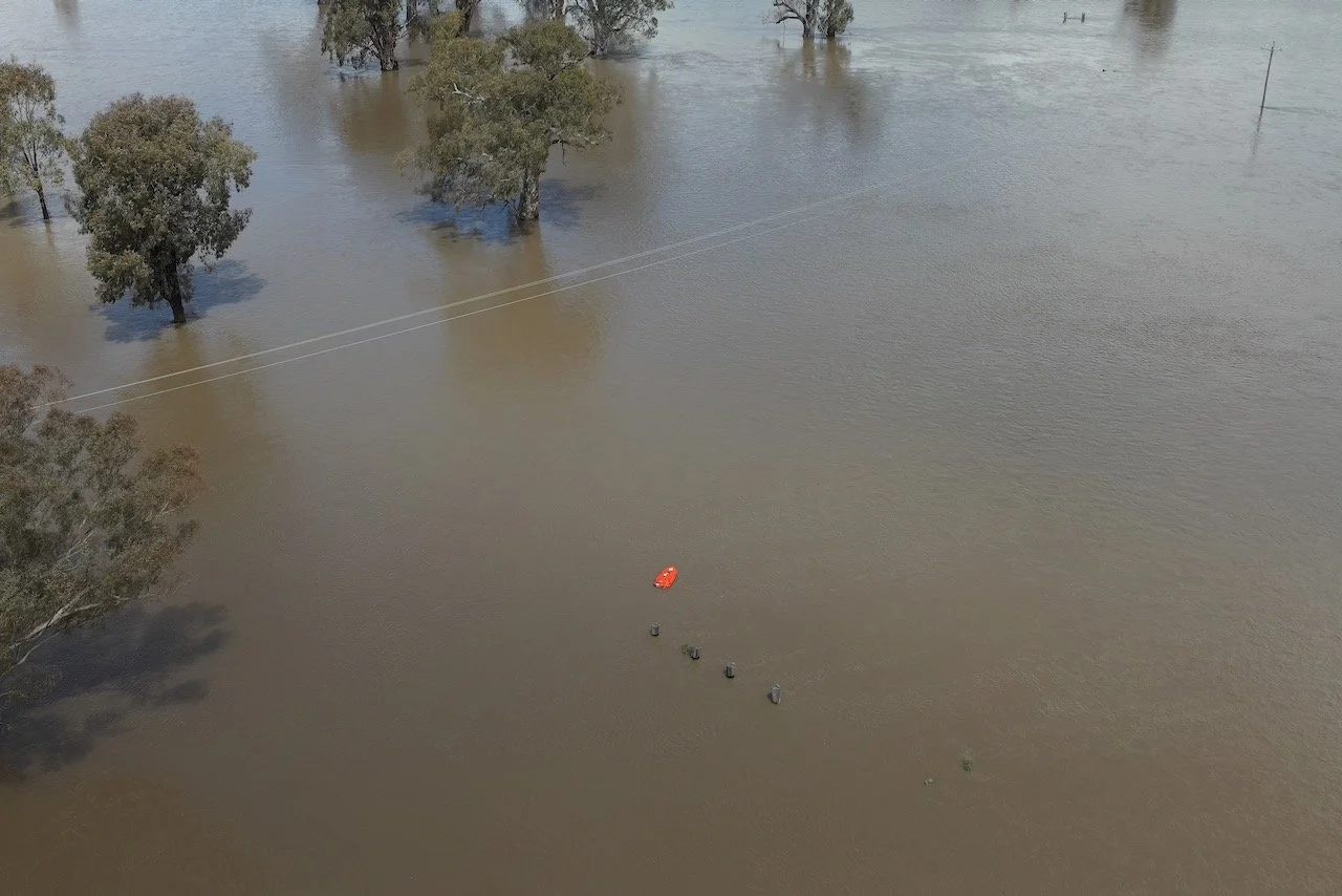
Water NSW uses a range of remote controlled boats equipped with depth-sounding and water velocity transducers to measure both depth and flow velocity through a stream profile. The problem in the case of the Gundagai floods was that the width of the flooded channel had grown to over 850m, making it impossible to view the boat during the survey and to determine its orientation. On top of that, there was a significant amount of debris coming down the waterway during the survey which could have damaged the boat.
The solution was to provide a realtime, aerial view of the boat to allow the operator to avoid floating debris and other obstacles including power poles, fencing, trees and the railway line.
The aerial oversight allowed the WaterNSW operator to avoid the floating and fixed obstacles by looking at an external monitor from the UAV. This included panning around to provide a warning of additional debris coming down the river and to warn of fixed obstacles in the path of the boat.
UAV-assisted bathymetric survey of the Murrumbidgee River at Gundagai